GivingTuesday · December 1 · Help keep 141 years of weather observations going.

Give now
Sign In Become a Member

Skyline Loop Trail

Blue Hills Trails

A 2.6-mile loop over five hilltops on the Blue Hills ridge, from Reservation Headquarters to Great Blue Hill and back.
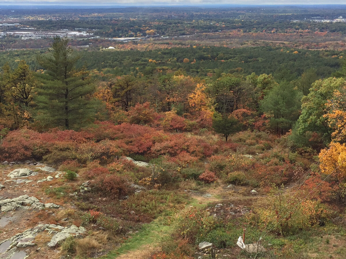
Fall color along the rocky ridge of the Skyline Trail in the Blue Hills
Fall on the ridge.

The Skyline Loop Trail is the classic Blue Hills workout, crossing five hilltops in under three miles. From Reservation Headquarters it climbs over the ridge to the top of Great Blue Hill, the highest summit in the range, and loops back on the other branch of the Skyline. Blue rectangles mark the way.

DistanceAbout 2.6 miles
Time2 to 2.5 hours
DifficultyChallenging
StartReservation HQ, 695 Hillside St, Milton

Trailhead parking

Directions to Houghton’s Pond →Directions to Reservation Headquarters →

DCR suggests parking at Houghton’s Pond and walking to Headquarters, where the trail starts.

The route

  1. Park at Houghton’s Pond, 840 Hillside Street, and walk to Reservation Headquarters. The trail starts behind the headquarters building.
  2. Climb the stone steps up Hancock Hill and follow the blue rectangles west along the ridge.
  3. Stay on the winding footpath over the ridgeline to Eliot Tower on the summit of Great Blue Hill. Climb the tower for the view toward Boston.
  4. To loop back, cross the stone bridge to intersection #1066 and turn left.
  5. Follow the southern branch of the Skyline back to Headquarters.

What you’ll see

The ridge

Open, rocky ledges along the top of the range, with views over the reservation. Fall color here is some of the best near Boston.

The summit

Eliot Tower and Blue Hill Observatory share the top of Great Blue Hill. The Observatory has recorded the weather here every day since February 1, 1885.
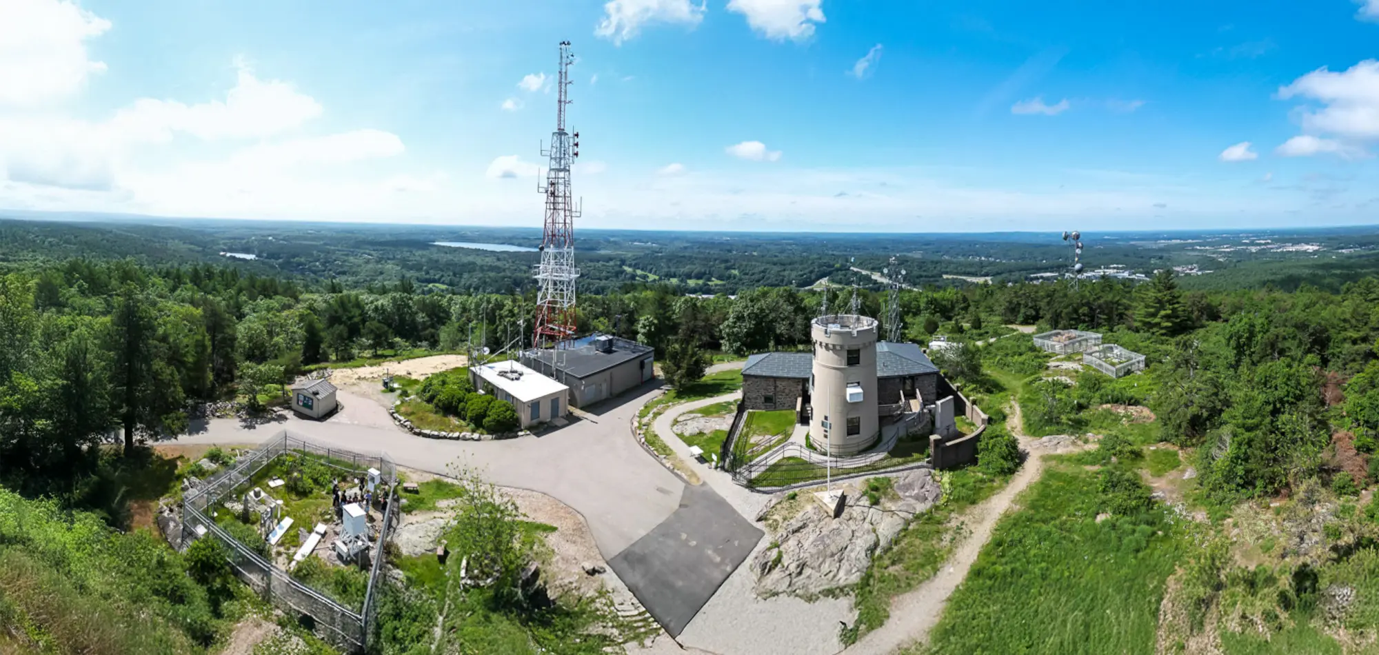
Aerial panorama of the summit of Great Blue Hill with Blue Hill Observatory
The summit of Great Blue Hill, where the loop turns around.
Make it a summit stop. With a ticket you can go inside the Observatory, see the exhibits, and climb its tower. Café 635 & Shop is open during public hours. Hours and tickets.

Before you go

  • If you get lost or hurt, call 911. Give the dispatcher the four-digit number on the nearest intersection post. Those numbers match the DCR map and help responders find you. For non-emergency park concerns, DCR’s 24-hour dispatch is (508) 820-1428.
  • Before you go, share your phone’s location with a friend, and tell someone your route and when you plan to be back.
  • Carry the DCR trail map. Many intersections have a white post with a four-digit number that matches the map. If you get turned around, find the nearest number.
  • Bring water, and dress for wind on the summits.
  • The reservation is open dawn to dusk. Dogs must be leashed. Carry out everything you bring in.
  • Timber rattlesnakes and copperheads live in the Blue Hills. They are shy. Stay on the trail and give them space.

FAQ

How long is the Skyline Loop in the Blue Hills?

DCR’s trail sheet lists the Skyline Loop from Reservation Headquarters at 2.64 miles, taking 2 to 2.5 hours.

Where does the Skyline Loop start?

Behind Blue Hills Reservation Headquarters, 695 Hillside Street, Milton. DCR suggests parking at Houghton’s Pond, 840 Hillside Street.

Is the Skyline Loop hard?

Yes. DCR rates it challenging. It climbs several rocky summits, including Hancock Hill and Great Blue Hill, with steep ledges and loose rock in places.

Can I visit the Observatory on the Skyline Loop?

Yes. Blue Hill Observatory is a short walk from Eliot Tower on the summit of Great Blue Hill. Check the Visit page for hours.

Guided hikes

Hike it with an Observatory guide

Our staff lead groups up Great Blue Hill, connecting the trail to the landscape, the climate record, and 141 years of daily observation. Every guided hike ends inside the Observatory.

Staff-led · By appointment, any day, year-round · Observatory tour included · From $250 per group, members save

See guided hikes

Route details are based on the Massachusetts Department of Conservation and Recreation’s recommended Blue Hills hikes. Trails and markers change, so carry the DCR map and confirm conditions with DCR at 617-698-1802.

Turn around at the top

Step inside the Observatory on Great Blue Hill, home of the longest continuous weather record in the Western Hemisphere.

Plan your visit See the summit now