This blog contains forecast discussions of pending significant weather events prepared by Robert Thompson, retired Meteorologist-in-Charge of the National Weather Service (NWS) Forecast Office in Norton, MA and former Board Chairman and current Board member of the Blue Hill Observatory and Science Center (BHOSC). The discussions are not a substitute for the official forecasts and warnings issued by the NWS Norton Forecast Office. They are intended as a complementary, educational resource for visitors to this web site. The forecast discussions provided here are the opinions of Mr. Thompson, and BHOSC accepts no liability associated with this information.
Significant Weather Outlook Updated Not a whole lot has changed in the outlook issued Monday, but a few modifications seem worth…
Significant Weather Weekly Outlook At this time, high heat and humidity for Tuesday and Wednesday look to be the most significant…
Significant Weather Weekly Outlook Updated Very warm and humid conditions are expected Thursday and Friday across southern New England but not…
Significant Weather Weekly Outlook Periods of Heavy Rain Through Tuesday Possible South of the Mass Pike Today through Tuesday A series of…
Significant Weather Weekly Outlook Excessive Heat Through Saturday Excessive Heat Warning for Most of Southern New England and Heat Advisory for the…
Updated Significant Weather Weekly Outlook Excessive Heat Mid to Late Week NWS has Issued an Excessive Heat Warning for Most of Southern…
Significant Weather Weekly Outlook Excessive Heat Likely for Mid to Late Week NWS has Issued an Excessive Heat Watch for Nearly All…
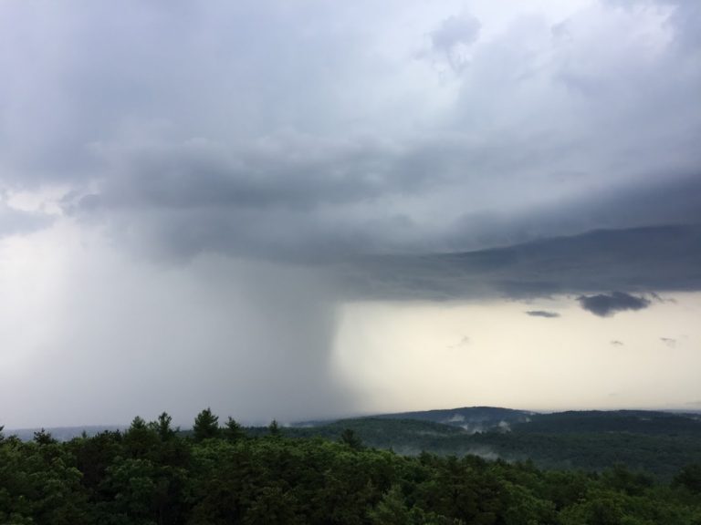
Scattered Late Afternoon/Early Evening Thunderstorms May Contain Strong Wind Gusts The combination of relatively strong vertical wind shear and moderate instability will…
Significant Weather Weekly Outlook A steady rain this afternoon and tonight will help make a dent in this year’s precipitation deficit to…
Risk of Severe Thunderstorms This Afternoon/Evening An approaching cold front may trigger strong to severe thunderstorms this afternoon and evening across southern…
Monthly Skymail, event announcements, and research summaries.