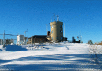
April 2014 Summary – Close to Average

Blue Hill Observatory April 2014 Summary: The month was notable for being less cold than recent months relative to the normal temperature and for being otherwise close to average.  The 24-hour mean temperature for the month of 46.1F was 1.4 degrees warmer the 120-year average for April, and this was very close to the 1981-2010… Read More »

March 2014 Summary – Cold with Little Snow

Blue Hill Observatory March 2014 Summary: The month was notable for many cold days and much below average snowfall.  The 24-hour mean temperature for the month of 31.1F was 3.3 degrees colder the 120-year average for March, and this was more than 4 degrees colder than the 1981-2010 30-year average.  In terms of this monthly… Read More »

Spring Open House at Blue Hill on May 31st 2014

Blue Hill Observatory Spring Open House Saturday, May 31st, 2014 from 10:00 am to 4:00 pm Enjoy browsing the Blue Hill Meteorological Observatory including views from the top of the tower. There will be displays by Mount Washington Observatory and US National Weather Service Boston MA – other presentations and activities will be listed when… Read More »

Winter 2013-2014 Summary – Ninth Snowiest on Record

Blue Hill Observatory Winter (December-February) 2013-2014 Summary: The meteorological winter season was very snowy with frequent cold and highly variable temperatures. The 24-hour mean temperature for the season of 27.3F was exactly equal to the 1891-2010 120-year average for the winter months, but this was significantly colder than the recent 30-year average winter temperature. Relative… Read More »

February 2014 Summary – Cold and Snowy

Blue Hill Observatory February 2014 Summary: The month was notable for many cold days and well above average snowfall.  The 24-hour mean temperature for the month of 26.4F was exactly equal to the 120-year average for February, but this was 2.7 degrees colder than the 1981-2010 30-year average, due to the very strong upward trend… Read More »

Blue Hill Observatory Annual Summary Graphs

These figures summarize the daily high and low temperatures, the normal temperatures, the temperature extremes, monthly precipitation, annual totals, largest storms and other important weather events for each year. Annual Summary Graphs 2020  2019  2018  2017  2016  2015  2014  2013  2012

January 2014 Summary – 10th Snowiest on Record

Blue Hill Observatory January 2014 Summary: The month was notable for very variable temperatures and for bringing significant snowfall.  The 24-hour mean temperature for the month of 24.8F was about one degree colder than the 120-year average for January, and the month was one half degree colder than the 1981-2010 30-year normal.  Daily temperatures were… Read More »

2013 Was Warmer, Wetter and Sunnier Than Average

The year 2013 ended with a 24-hour corrected mean temperature of 49.5F, which was 1.9F warmer than the 120-year average and 0.6F above the 30-year normal. This was the coolest year since 2009. The maximum temperature for the year was 95F on July 19th and the coldest temperature was 0F on January 24th. There was… Read More »